Agency: NASA
Period: 8/17-09/22
People: Steve Saleeby, Leah Grant, and Sean Freeman
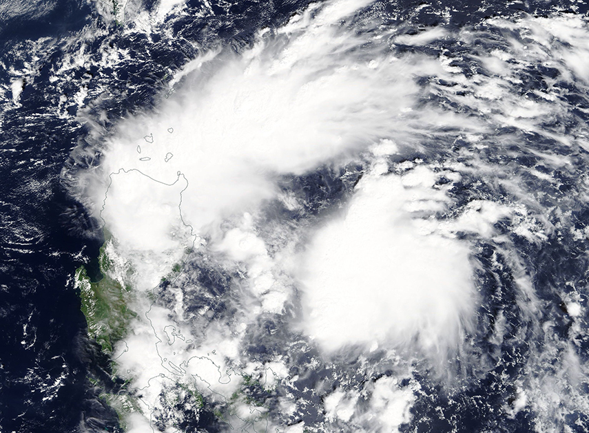
Previous work has demonstrated that changes in aerosol number concentration and type can significantly impact both the microphysics and dynamics of convective clouds. However, simulations of these effects are not consistent due, in part, to a lack of understanding of aerosol-microphysical interactions and a lack of observations to evaluate the modeled interactions. To help overcome this barrier, we will be collecting detailed high-resolution co-located measurements of aerosols, clouds, and meteorological properties during the Clouds Aerosol Monsoon Processes Philippines Experiment (CAMP2Ex). Our group will be deployed in the field during CAMP2Ex in July-August 2018, dropping dropsondes from the NASA P-3 to collect in situ observations of thermodynamics and winds. RAMS simulations are also being conducted to investigate the impacts of, among other things, biomass burning and dust on shallow convection and congestus in the Maritime Continent.
Agency: Office of Naval Research
Period: 8/16-09/21
People: Steve Saleeby,
Ben Toms, Aryeh Drager, and Stacey Kawecki
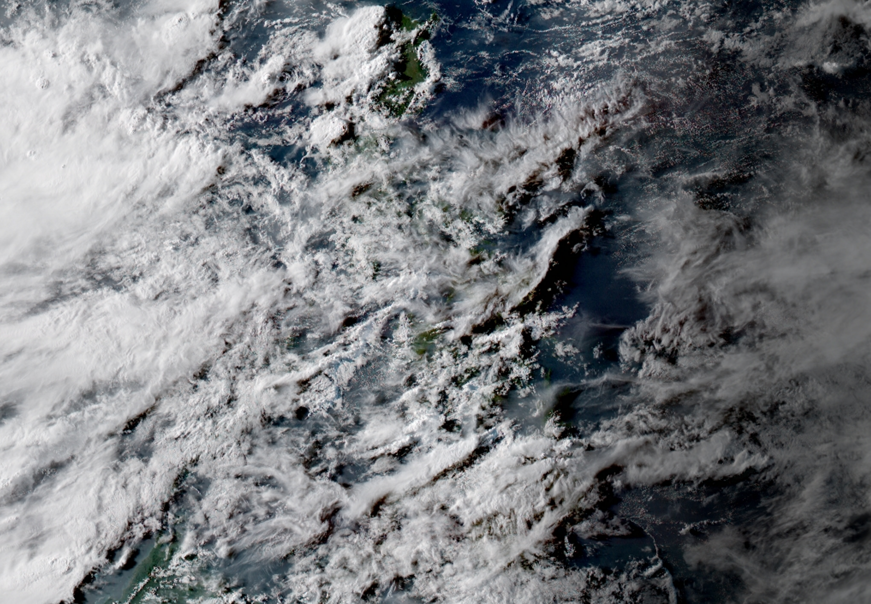
Deep convection is a critical component of the hydrological cycle and radiative energy budget within the Maritime Continent. The evolution of convective systems of varying scales has been shown to be dependent upon environmental variables such as atmospheric profiles, sea-atmosphere interactions, and orography. This complex interaction influences the cascade of energy between storm-, meso-, and synoptic scale circulations, and may even impact sub-seasonal oscillations such as the Madden-Julian Oscillation (MJO). Through this research, our group will utilize RAMS to simulate both basin-scale and idealized, mesoscale domains to study the interactions between deep convective cells and their surrounding environment. The knowledge gained from this study will contribute to field operations within the Propagation of Intra-Seasonal Tropical Oscillations (PISTON) field campaign.
Agency: Office of Naval Research
Period: 10/15-09/20
People:
Steve Saleeby, Minnie Park, Jennie Bukowski, and Stacey Kawecki
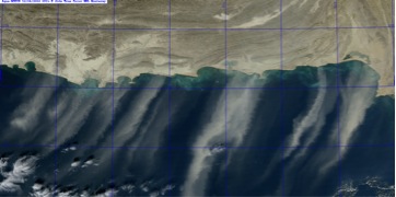
Strong gradients in land and ocean surface properties in littoral zones lead to unique meteorological conditions, and these same gradients cause difficulties in the prediction and observation of aerosol spatial distributions. For example, in the image to the right, dust plumes are easily detected over the water, but are difficult to see over land. In this multi-disciplinary study, a team of scientists from several universities and cooperative institutes is using a combination of new observational capabilities, data assilimilation techniques, and modeling work to improve the prediction of the 3D aerosol distribution in littoral zones. Our group is focusing on determining the modeling and environmental factors which most influence the prediction of the 3D aerosol distribution through the use of idealized modeling and case studies.
Agency: NASA
Period: 08/15-08/18
People: Sean Freeman, Leah Grant, and Peter Marinescu
The fundamental research question that this research hopes to solve is "How can satellites be used to forecast conditions conducive to severe storm and tornado formation?" Tornadoes impact millions of people in the United States each year. Understanding the links between environmental factors and tornadogenesis, the formation of tornadoes, is crucial for improving forecasts and early warnings. In this project, our group is using extremely high resolution atmospheric models to simulate tornadogenesis in supercells to enhance our understanding of the factors that lead to tornadic development. The modeling data that our group produces will be used to lead to simulate observations taken by the A-Train satellite constellation at the Jet Propulsion Laboratory to answer our science question. Using these data, we will have a better understanding of how and to what extent satellite data can be used to better predict severe storms and the development of tornadic storms.

Agency: DOE
Period: 08/13-08/17
People: Steve Saleeby
and Peter Marinescu
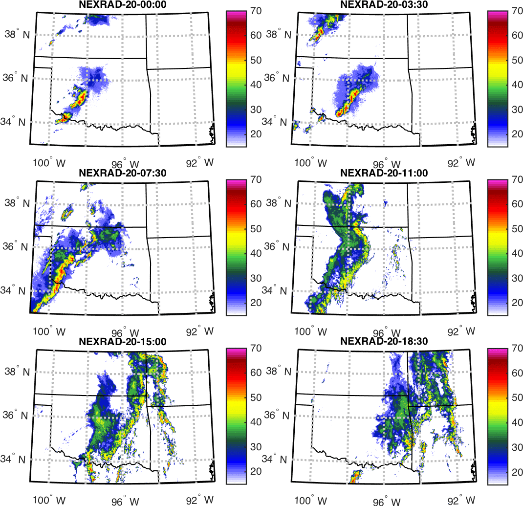
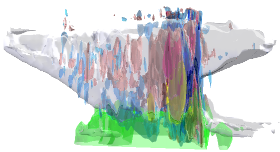
The amount and location of aerosol particles vary significantly across different regions of Earth. In the Southern Great Plains of the United States, smoke particles from biomass burning, dust particles from agricultural and/or dry regions, and particles from anthropogenic sources can all make their way to various altitudes in the atmosphere. The Southern Great Plains is also the home to a high frequency of mesoscale convective systems (MCSs), which are organized and expansive cloud systems that play an important role in the Earth’s weather and climate systems. This research focuses on understanding how the amount and vertical location of aerosol particles present in the atmosphere impact MCS lifetime, cloud characteristics, and precipitation amounts through simulating two MCS events from the Midlatitude Continental Convective Cloud Experiment (MC3E) using the cloud-resolving model RAMS.
Agency: NASA
Period: 08/13-08/17
People: Amanda Sheffield
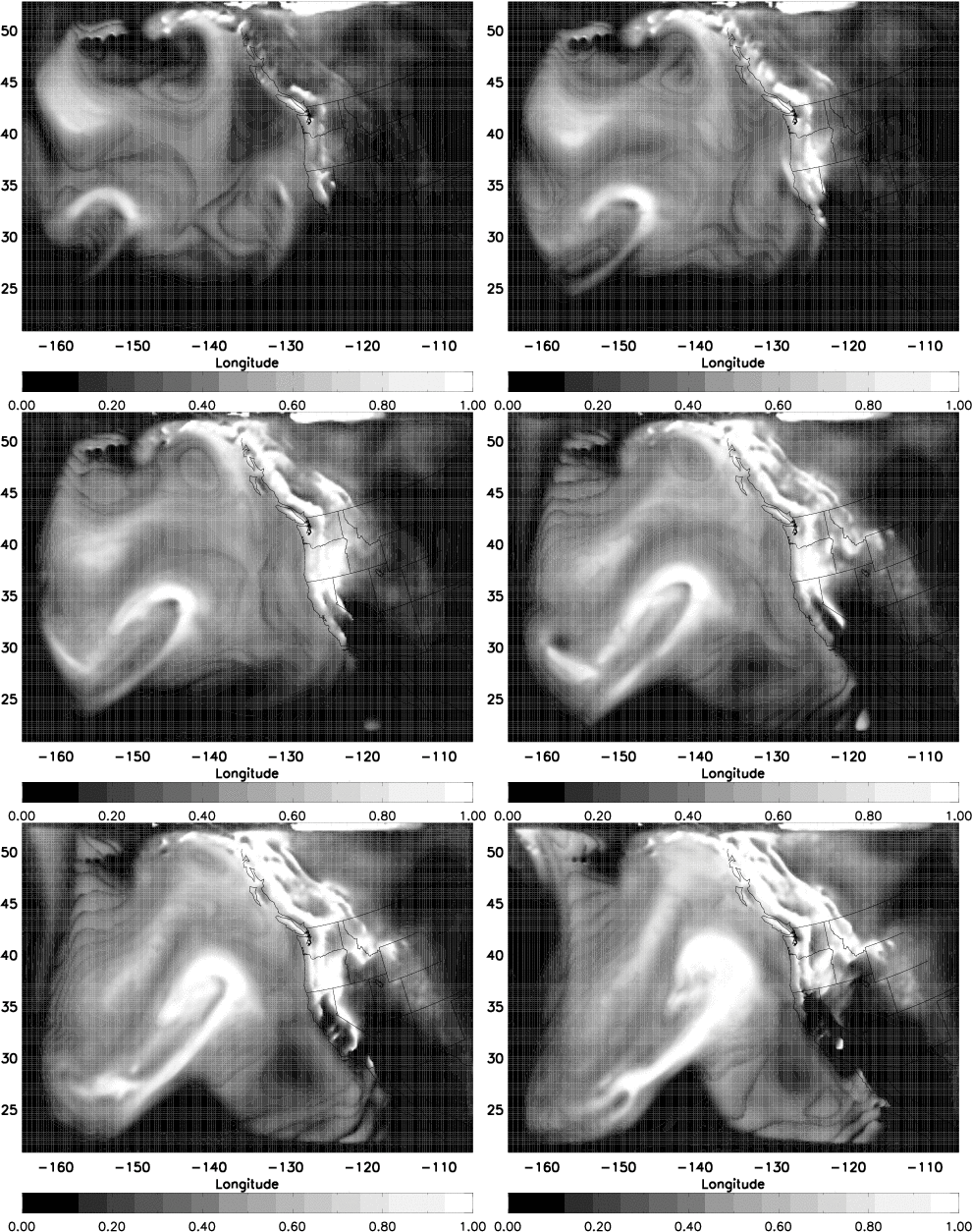
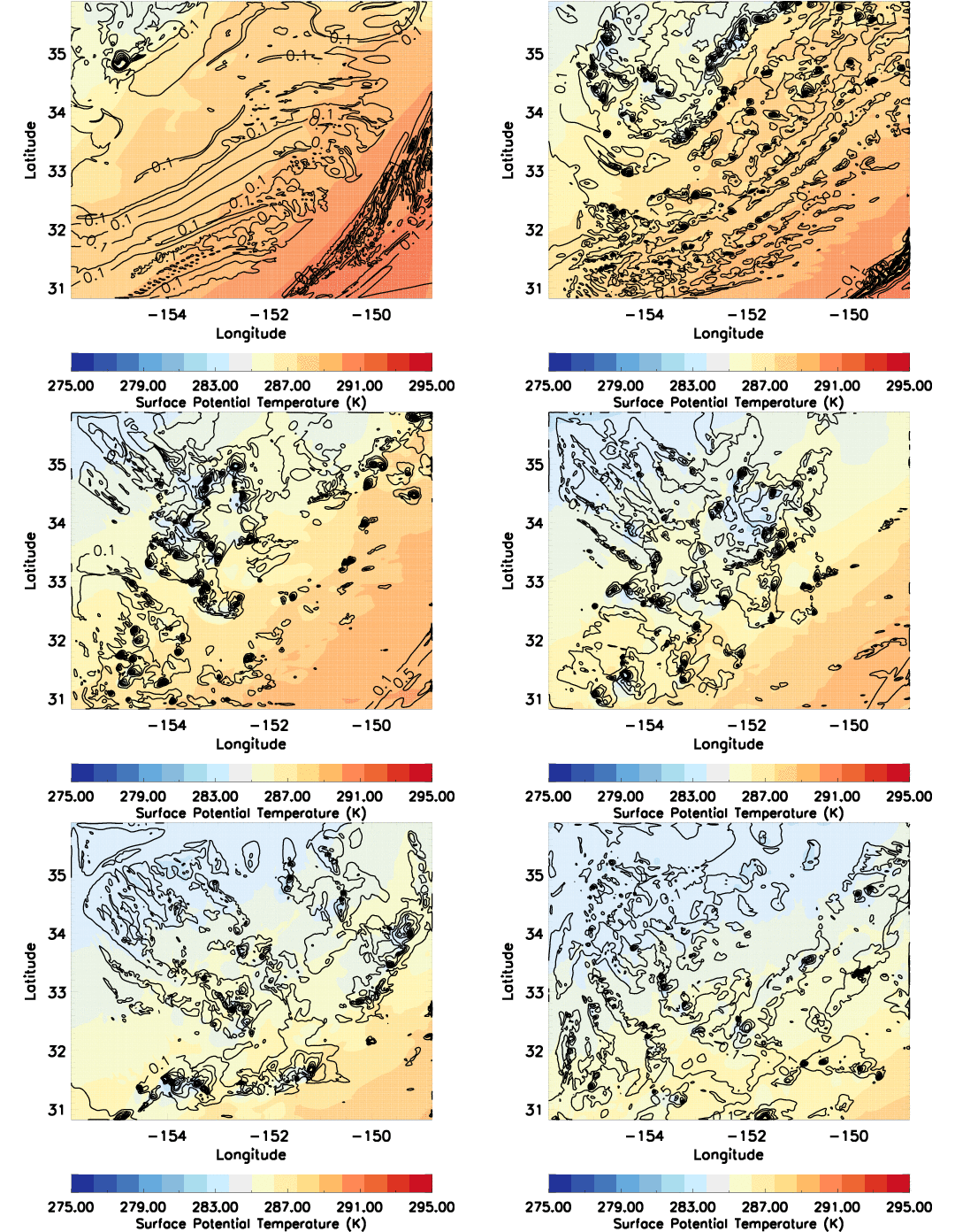
Extratropical cyclones (ETCs) are a major control of midlatitude weather and climate as they globally redistribute heat and moisture. Enhancing our understanding of ETC development and predictability is necessary as society is often dependent on these weather patterns, including for regional and local water resources, and in preparation for a changing climate. Recent research has shown the importance of mesoscale features on and within these synoptic scale systems, including the impact of aerosols on clouds and fronts. This collaborative study combines both observational and cloud resolving modeling techniques to investigate the cloud structure of ETCs, including the impacts of environmental characteristics such as aerosol.The Cloud Processes Group’s recent contribution to this study is the investigation of the development of the post-cold frontal (PCF) region (see PCF animation). With RAMS, we are simulating a wintertime ETC and its respective PCF region with advanced microphysics and at high spatial and temporal resolutions. These novel simulations allow us to examine the PCF cloud characteristics in order to better understand their cloud microphysical and dynamical development, including formation of the updraft, precipitation, and their horizontal and vertical cloud distribution. We are also examining changes to these characteristics with environmental conditions such as sea surface temperature and cloud nucleating aerosol. These cloud characteristics impact how this region processes water vapor, including how the vertical and horizontal fluxing of water vapor within this region links to overall ETC moisture transport.
Agency: NASA
Period: 08/13-08/17
People: Steve Herbener
and Steve Saleeby
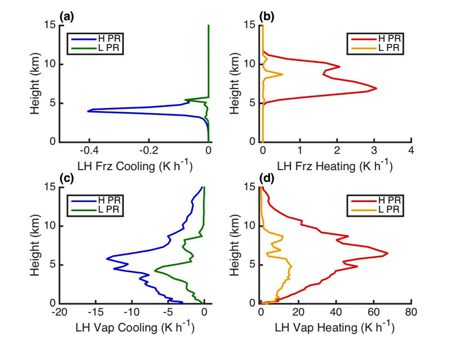
Weather forecasting has tremendously benefited from the advancement of remote sensing (e.g. radar and satellite) technology in the arenas of predicting both daily weather patterns and hazardous weather events. The ability of remote sensing to assist with weather forecasting will be enhanced as the amount of information that can be gleaned from instrument output increases. One line of exploration in this project is to use a cloud-resolving model (CRM) to assist with broadening the scope of the inferences that can be accomplished through remote sensing. For example, a CRM can be used to find relationships between precipitation and many atmospheric conditions including diabatic heating due to phase changes between ice, water and vapor (see figure). Consequently, the relationships discovered through modeling can be utilized to add to the set of atmospheric quantities that can be measured by remote sensing technology.
Agency: NASA
Period: 11/13-10/16
People: Emily Riley
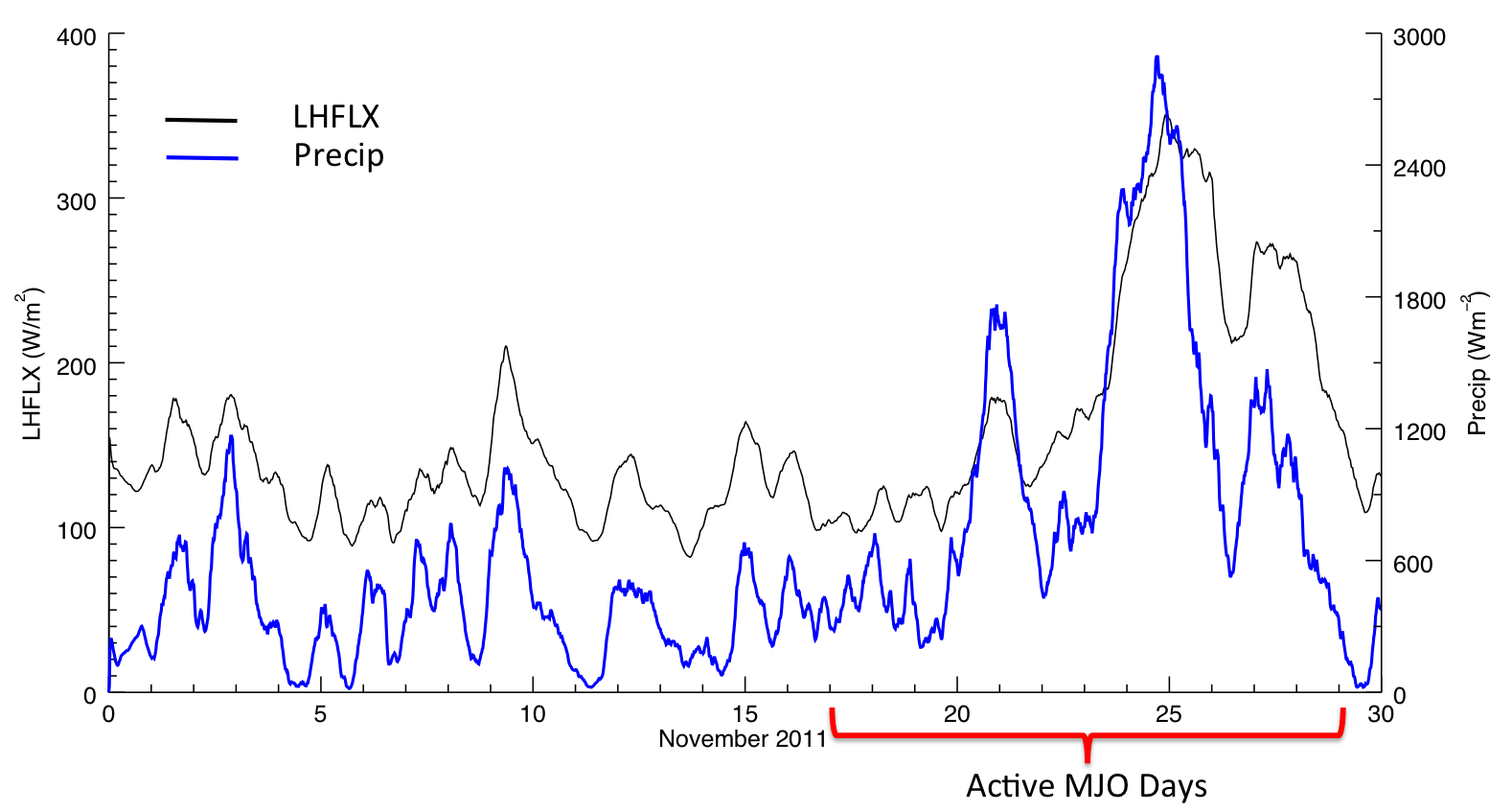
One question this study addresses is What is the role of wind induced energy exchange (i.e. latent heat flux feedbacks) between the Indian Ocean and its overlying atmosphere at initiating or maintaining deep precipitating clouds associated with the Madden-Julian Oscillation (MJO)? Latent heat fluxes are one source of atmospheric moisture, where moisture is a key ingredient to thunderstorm development. The MJO can be thought of as a packet of many thunderstorms that move from the Indian Ocean to the central Pacific over the course of several weeks. A cloud resolving model is used to simulate an actual MJO event. By altering how the LHFLX are “felt” by the overlying atmosphere we quantify how precipitation and cloud xorganization change through the evolution of the MJO event.
Agency: NSF
Period: 08/14-07/17
People: Steve Herbener
and Steve Saleeby
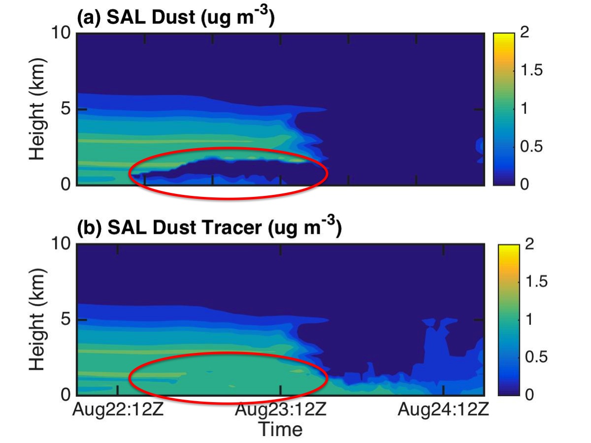
Tropical convection encompasses a large range of phenomena including hurricanes, which are examples of tropical cyclones. A primary line of investigation in this project is to explore how tropical cyclones process dust that is being transported to the storm within the Saharan Air Layer (SAL). An integrated suite of methodologies (aircraft observations, satellite observations, and cloud resolving modeling) is being utilized to accomplish this task. Our group is responsible for the cloud resolving model piece of this project, and we have recreated a realistic reproduction of the interaction between Tropical Storm Debby (2006) and a strong SAL event. By inserting “dust tracers” into this simulation, we can identify and track precipitation processes that are removing dust from the atmosphere and wind related events that are transporting dust to different levels of the atmosphere.
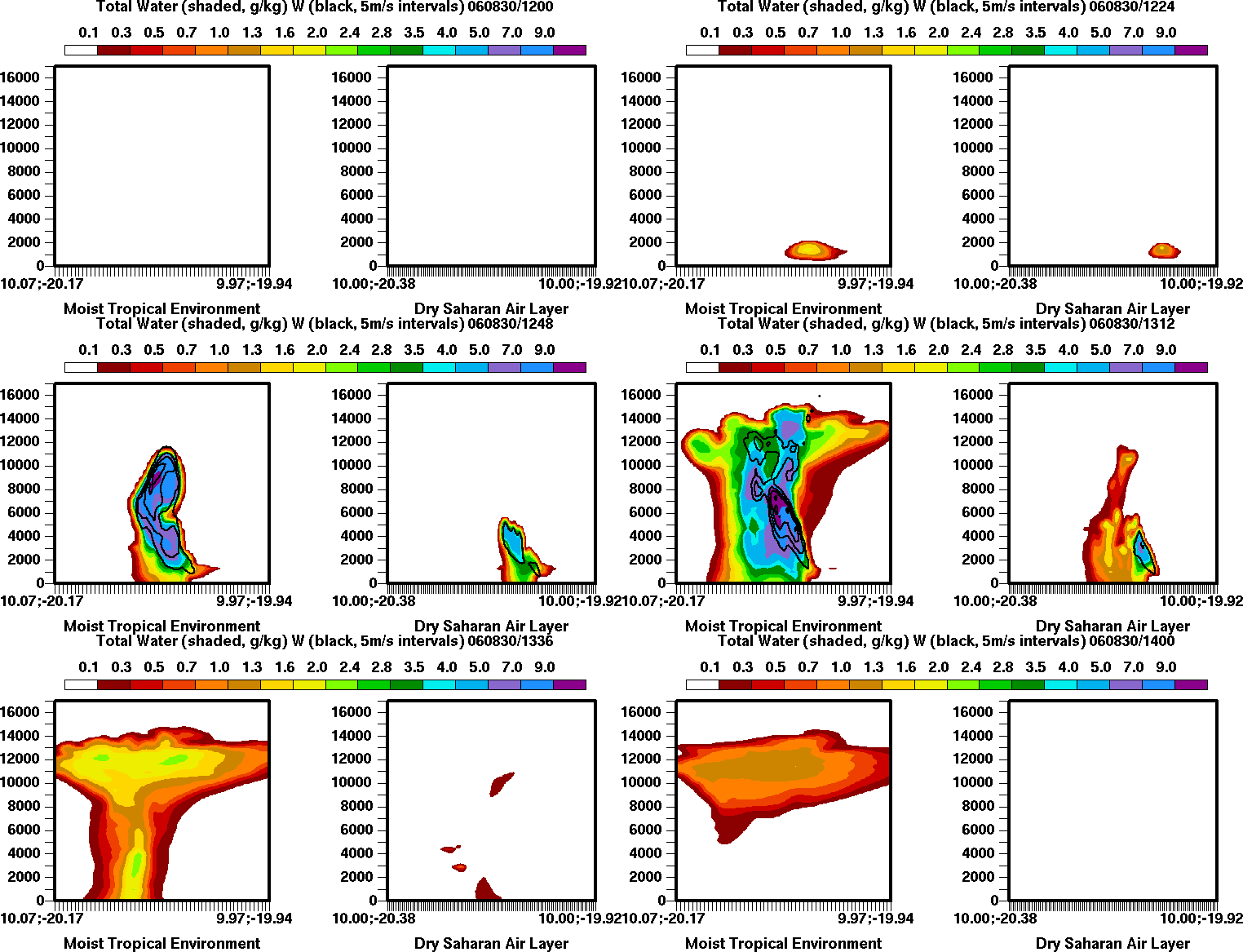
In this study we are also investigating how the dry and dusty air of the Saharan Air Layer (SAL) may impact the lifecycle of ordinary tropical convection and the subsequent processing and transport of dust via deep convection. While the addition of dust may promote greater formation of cloud droplets and stronger convection, the drier and more stable SAL may limit convective development. If convection does form, microphysical processes may efficiently remove some of the dust through scavenging and deposit this dust to the ocean, thereby adding key nutrients to the ecosystem. Meanwhile, dynamic processes may loft dust to upper levels where residence times may be quite long and allow for long-range transport. The animated figure shown here displays a vertical cross-section through convection that is forced from surface convergence. The left side shows convection forming within a moist tropical environment, while the right panel show convection forming within the dry SAL environment. This demonstrates that the stable, dry air within the SAL tends to limit the development, strength, and duration of tropical convection.
Agency: NSF GRFP
Period: 06/14-05/17
People:
Leah Grant
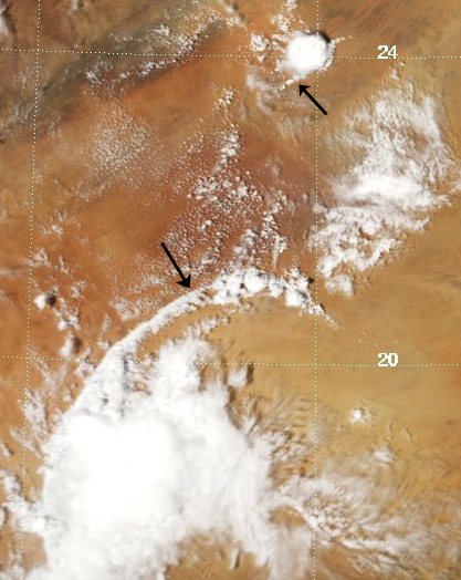
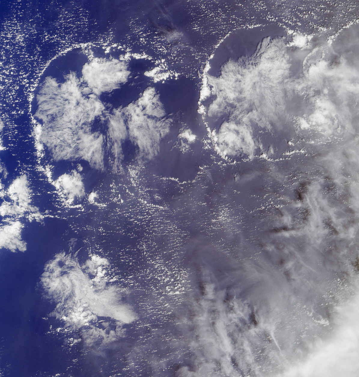
Cold pools are negatively-buoyant pools of air that form from evaporation and melting of precipitating particles like rain and hail. They are ubiquitous in the atmosphere and play important roles both in initiating new convective storms and in helping to organize systems of storms. As is clear from the satellite images to the right, cold pools occur over a variety of land surface types. Energy and moisture exchanges between the air and the surface, called surface sensible and latent heat fluxes, are very different among these regions. Yet very little is known about how these surface fluxes impact cold pools, their lifetime, their intensity, and their ability to initiate new storms. This research aims to answer the question, “how do surface fluxes influence cold pool evolution?” by using idealized numerical simulations of cold pools occurring in a range of environmental conditions and over varying surface types.
Agency: NSF GRFP
Period: 06/14-05/17
People:
Aryeh Drager
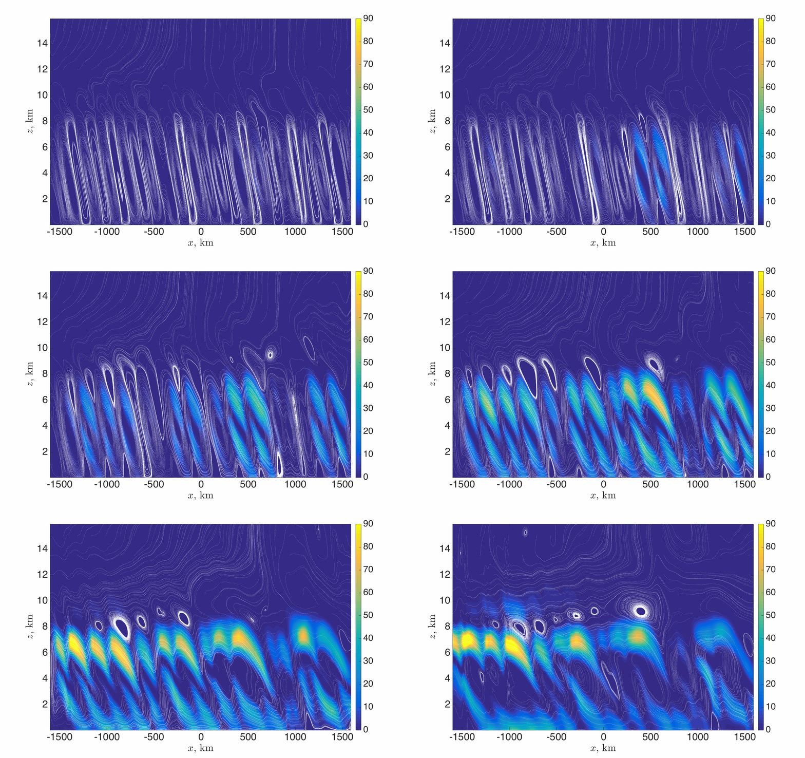
Symmetric instability has received considerable attention for its role in multiple meteorological phenomena, particularly its potential role in the development of mesoscale banded precipitation structures in extratropical cyclones. This study investigates the role of an environment's theoretically favored updraft slope in the release of its symmetric instability through a series of idealized model simulations. The physical mechanisms giving rise to the model results are being investigated.
Agency: NSF GRFP
Period: 06/14-05/17
People:
Aryeh Drager
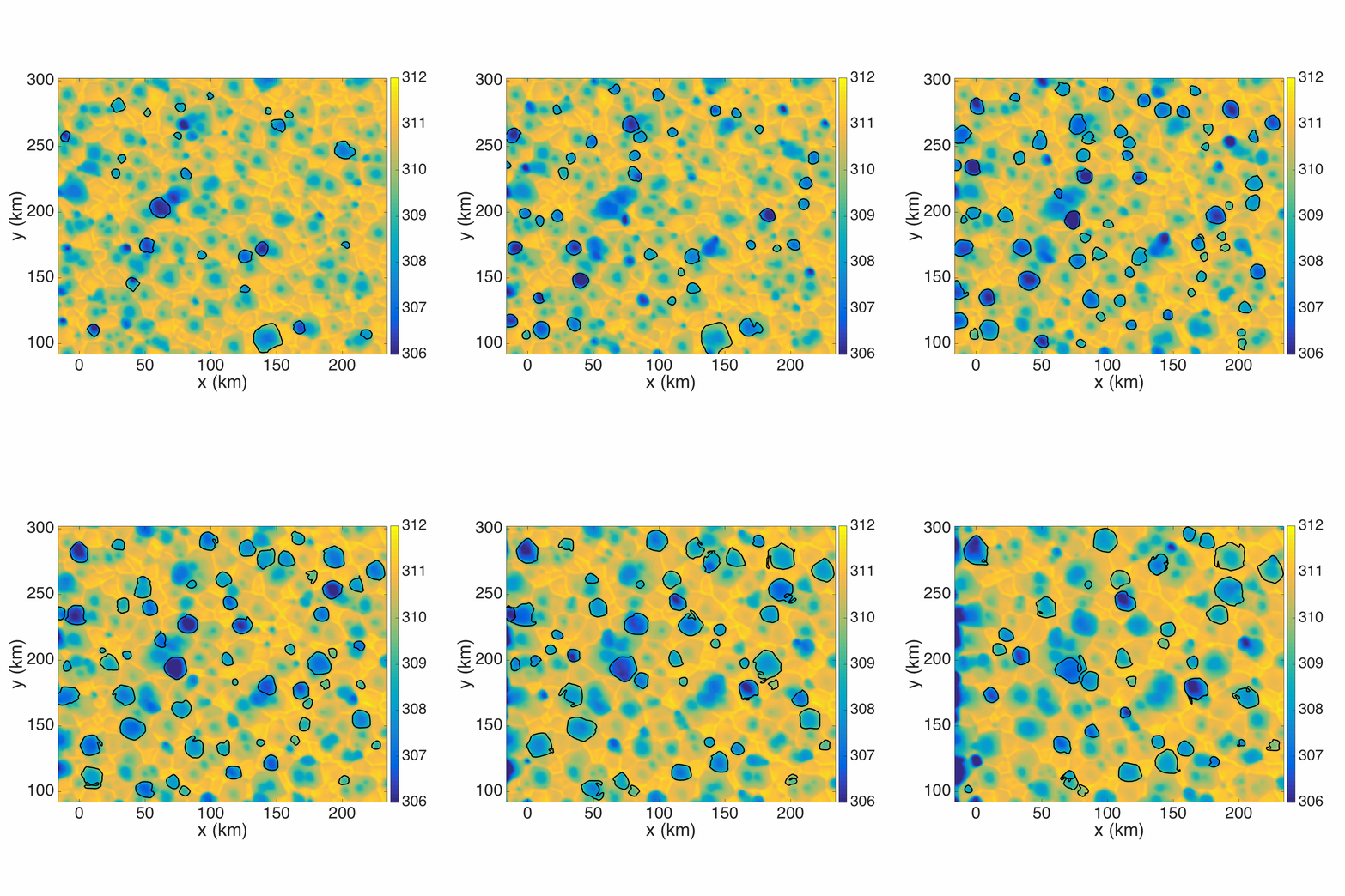
Convective cold pools are the blasts of cool air that we experience near the ground in association with thunderstorms, and they can play an important role in triggering the formation of new storms. For this project, we have developed a new automated method for identifying and tracking the cold pools that form in numerical model simulations. In the animation at right, the colors correspond to the density potential temperature ~50 meters above ground, which is the variable we use to determine the cold pool boundaries (blue = denser air). The boundaries of the tracked cold pools are shown in black. Once cold pools have been tracked, it is possible to calculate statistics and generate composites of all of the cold pools in a simulation. We can then compare the ensemble of cold pools in one simulation to that in another. Currently, we are investigating questions such as “How does soil moisture affect cold pool properties?” and “How do atmospheric aerosols affect cold pool properties?” by running simulations in which soil moisture and atmospheric aerosol content differ from one simulation to the next and analyzing the properties of the cold pools in each simulation.
