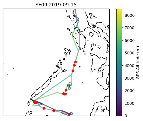
Download Data from this drop (NetCDF)
Drop notes: Late winds, obtained about 1:30 post-drop. Dropped into opaque midlevel cloud layer North of SW-NE convective line
Download Data from this drop (NetCDF)
Drop notes: Good drop. Also dropped in more or less opaque midlevel cloud layer to N of SW-NE convective line
Download Data from this drop (NetCDF)
Drop notes: Late winds (>2 mins post drop). Dropped to S of SW-NE convective line in relatively clear area, some clouds below
Download Data from this drop (NetCDF)
Drop notes: Good drop, launched immediately after wings level into HSRL leg. Few scattered cumuli and lots of haze/smoke below
Download Data from this drop (NetCDF)
Drop notes: Good drop, second drop along HSRL line. Similar temperature profile to previous, but notably drier 750-800 mb layer on this drop with a shallow isothermal layer around 800 mb
Download Data from this drop (NetCDF)
Drop notes: Good drop. Shallow cloud layer just above 600 mb, dry layer around 750 mb now followed by moisture spike below also colocated with thicker isothermal layer around 775-810 mb
Download Data from this drop (NetCDF)
Drop notes: Good drop, last drop along HSRL line prior to box spiral. Several shallow isothermal/inversion layers between 700 and 850 mb
Download Data from this drop (NetCDF)
Drop notes: Good drop, timed with ASTER satellite overpass. Several shallow inversion or isothermal layers but no readily obvious cloud penetrations
Download Data from this drop (NetCDF)
Drop notes: Good drop. Launched more or less right over a shallow convective line, appears to have penetrated cloud around 800-850 mb
Download Data from this drop (NetCDF)
Drop notes: Good drop. Launched to the east of the convective line in a relatively clear area with some scattered cu below
Download Data from this drop (NetCDF)
Drop notes: Good drop, launched to west of convective line. Line had begun breaking up/losing organization at this point